Nov 152010
 

Jack London (the Park) Turns 50…

and Needs a Hand.

During the summer of 2010 Jack London State Historic Park hosted several birthday events. Jack, had he been there, would have enjoyed them all.

jack london park preserve sonoma mountain

Organized and led by park neighbor and volunteer activist Elisa Stancil of the Valley of the Moon Natural History Association, events included a mid-May Plowing Playday which highlighted aspects of Jack and Charmian’s Beauty Ranch; a “Celebrate the Park” festival in June with food, wine tasting, music and other revelry, dampened only by the 100 degree heat that day in the meadow; and finally, a romantic, elegant, full-moon blessed, catered, alfresco dinner for 100 at the London ranch house in July.

Under the umbrella of non-profit VMNHA, Stancil has created the Jack London Lake Alliance, which focuses fundraising efforts on a plan to restore Jack London Lake, a feature of the Beauty Ranch that Jack loved.

Built in 1915, the lake captures water from Sonoma Mountain springs and annual runoff. Over the years the curved dam holding the lake has weakened and the lake has filled with sediment, a threatening combination.

Downstream erosion has increased significantly since 1989 when the State Parks installed a poorly designed side spillway. Sediment harms fish and wildlife populations in Kohler, Asbury and Sonoma Creeks, according to a number of recent studies. For more information on lake restoration and to a make a donate to VMNHA, go to www.jacklondonpark/VMNHS.com

Nov 092010
 

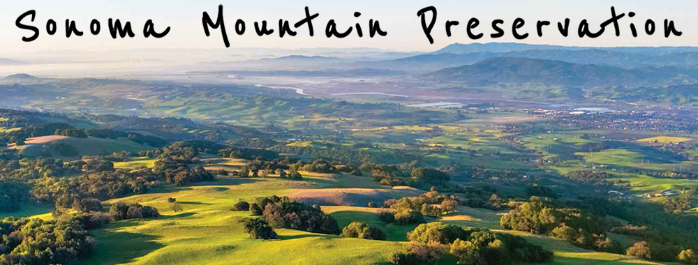
Recreation on the Mountain

jack london sonoma moutain visit

Recreation on the mountain can include wine tasting, visiting Morton’s Warm Springs, attending a retreat at the Westerbeke Ranch, or, as most visitors and residents do, heading to a park, principally Jack London State Historic Park.

To reach Jack London State Historic Park, take London Ranch Road south out of Glen Ellen and follow it to the end. Parking costs $7/day. No dogs are allowed out of the historic section of the park, which is near the entrance. Bikes are restricted to designated fire roads and several trails. Cyclists need to watch for sign at trailheads and observe season restrictions.

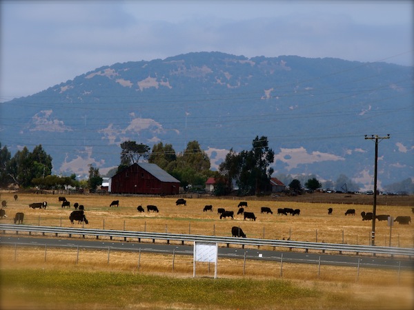
First time visitors often start by touring the historic buildings, including the burned-out Wolf House, the summer cottage and museum, and the barn and must-see Pig Palace.

Then on to the hikes.

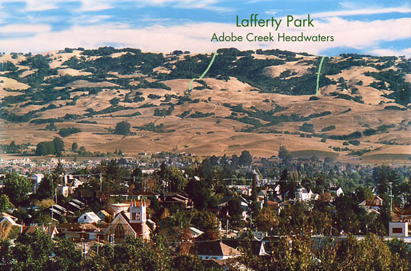
Major trails inside Jack London State Historic Park include the Mountain Trail, a six-mile round trip, which starts at the parking lot and climbs past London Lake to the top of Sonoma Mountain, via either the Summit Trail or the Hayfields Loop.

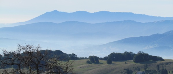
Signage along the way makes sense and can easily be followed. The Sonoma Ridge Trail, a 10-mile loop, begins about two miles from the parking lot, leaves the Mountain Trail to the left and rises along a ridge to afford great views of Sonoma Valley, Mt. Diablo, Mt. Tamalpais, Mt. St. Helena and much of the Bay Area.

Shorter trails take off from the Mountain Trail around London Lake, including Fallen Bridge trail (yes, there is a fallen bridge) which follows Asbury Creek canyon into the old London Ranch orchards and some old growth redwoods. For the adventurous, several steep trails lead down to the Sonoma Development Center’s peaceful Fern Lake.

Trails also wander through the old Jack London Beauty Ranch orchard (pear trail, apple trail, etc.) and circle the historical buildings, including the Wolf House ruins.

New Trails

Two lengthy new trails are in the works. The first, called the North Slope Sonoma Mountain Ridge Trail, currently under construction, will run 4.25 miles, connecting on the east with the Hayfields Loop in JLSHP and the west with a new public parking/trail staging area at Jacobs Ranch, about three miles up Sonoma Mt. Road, going east from the fire station on Bennett Valley Rd. The trail will end at one of the highest points in JLSHP. Rising along the north slope of the mountain, it will afford view of the Mayacamas Range and Sonoma Valley to the east and Santa Rosa to the west. It will also, eventually, comprise a section of the Bay Area Ridge Trail.

Jacobs Ranch, an Open Space District preserve, may be open for short hikes, depending on conditions of access roads. Check with Sonoma County Open Space District before trying to enter.

Another ambitious undertaking, the South Slope Trail, with a planned ground breaking in April 2011, will add about four miles to the Sonoma Ridge Trail (see above). It will provide a 140miles round trip from the JLSHP parking lot. Watch our website for news on this major feature.

To get started exploring the mountain, you can enjoy organized hikes with trained and knowledgeable leaders. Contact the non-profit LandPaths and/or state parks volunteers Bill Meyers or Dave Chalk at (707) 539-8847 or to the website for State or Regional Parks.

Dave and Bill offer monthly hikes at 10 a.m. on Saturdays. Most hikes average about 40 participants and are as much social event as hiking exercise. Hikes are called moderately strenuous, but the do end with a tailgate party in the parking log.

Horses

You can bring you own horses to Jack London State Historic Park, parking your trailer in the upper parking lot at the far west end. Horses must stay on designated fire roads and trails. Guided trail rides can arranged by calling Triple Creek Horse Outfit in Glen Ellen (707) 887-8700 or go the their website.

Retreat to the Mountain

For a romantic, low-key, somewhat rustic getaway, redolent with history and steeped in the culture of the mountain, few places compare with Westerbeke Ranch, off Grove Street, west of Arnold Drive in Sonoma. The property that is now Westerbeke Ranch was purchased by long time residents Richard and Muriel Van Hoosear as a vacation retreat for themselves and their three daughters. The buildings and grounds developed as their family grew. Richard and Muriel loved to travel and on each trip to Mexico or Spain they returned with new architectural ideas and decorations.

In the late 1960’s the ranch was transformed into the conference center it is today. The Westerbeke family invites visitors to enjoy their home and workplace. To make an appointment for a tour, for more information about weddings or other events at the ranch, or for additional information, go to their web site www.westranch.com.

Stop and View the Flowers

Another Van Hoosear family contribution to the region consists of the 163-acre preserve at the foot of Sonoma Mountain off Carriger Road known and treasured for its abundance and variety of wildflowers. Over 250 species of common and rare wildflowers and native grasses thrive throughout the property. Carriger Creek, a tributary of Sonoma Creek, runs through the preserve. The property is managed by the Sonoma Ecology Center, with dual goals of protecting the preserve’s botanical, aquatic and wildlife values and providing public access for educational purposes. Now protected by an Open Space District conservation easement, the preserve welcomes visitors by guided tour each year during the spring when the flowers are at their peak. Reservations are required and space is limited; for reservations, contact Elly Seelye at (707) 996-0712 ext. 124, or email elly@sonomaecologycenter.org. A donation of $20 per adult and $10 per child is requested, though no one will be turned away.

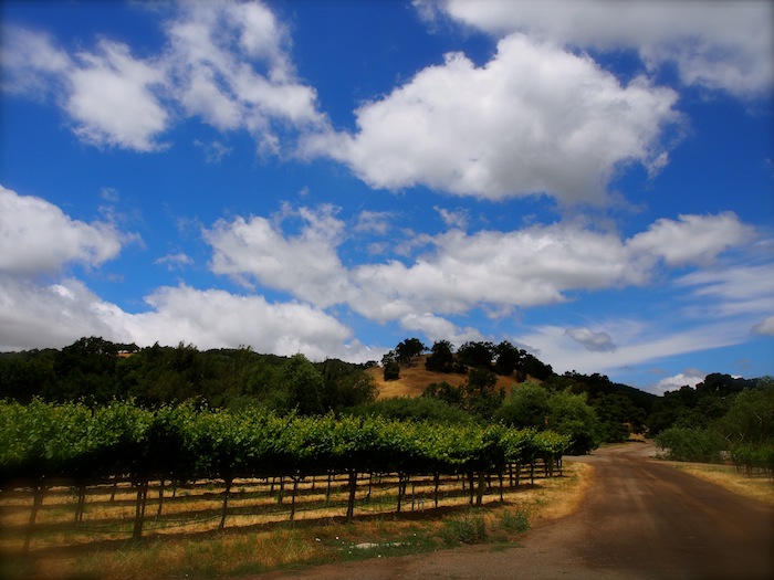
Go Organic Wine-tasting and Take a Vineyard Tour

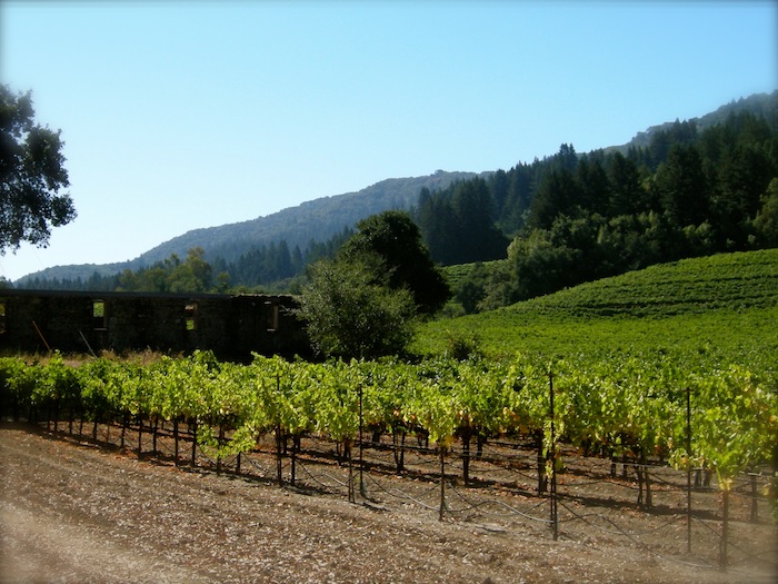
On your way to or from Jack London State Park, pull of London Ranch Road into the Benziger Family Winery. The entire portfolio of Benziger wine is certified sustainable, organic or biodynamic.

The Benziger family has been growing grapes on Sonoma Mountain for almost 30 years. According to the co-owner Chris Benziger, his brother Mike and sister in-law Mary discovered the vineyard in the late 70’s and purchased it with help form their parents. Three other brothers and a sister joined the business.

“In the beginning we farmed the same way as everyone else around here. You spray to keep the weeds in check, to keep the bugs away, and to increase yields,” observed Chris. But, he added, after a few years Mike pushed the family to consider something different.

To discover the results of their transition to a more sustainable yet still commercially viable model, go to their website www.benziger.com for information on tours and tastings.

Meditate at a Zen Center

The Sonoma Mountain Zen Center (or, Genjoji) is an 80-acre Soto Zen practice center located on Sonoma Mountain Rd.

Founded by Jakusho Kwong and his wife Laura Kwong in 1973, Kwong-roshi is the current guiding teacher of the Zen center. The center offers residential training and a practice regimen for local members and visitors from all over.

The Zen Center supports itself through members’ donations, proceeds from its Zen Dust bookstore, and by offering rooms for rent.

Author Sarah Ban Breathnach described the center in her book A Man’s Journey to Simple Abundance:

“Near the top of the mountain, the road dips, bends, then snakes through a small grove of redwoods. The dense canopy blocks all ambient light, so that when you emerge on the other side of the grove, you feel as though you’ve passed through a portal into another world. It’s a fitting way to approach Sonoma Mountain Zen Center, because people there view reality just a little bit differently from the way most of us do.” For more information on programs and access, go to www.smzc.net.

Soak and Swim in a Warm Spring

Bordering Sonoma Creek just west of Glen Ellen and nestled among a canopy of large oaks, open meadows and rolling hills, Morton’s Warm Springs is perfect for picnics, reunions, family recreation, corporate retreats and meetings, weddings, and class field trips.

The Wappo Indians, early residents of the area, recognized the healing properties of the geothermal mineral springs and considered the waters sacred.

In 1939 Ethel and Harold Morton purchased the property and began operating it as Morton’s Warm Springs Resort. The site not includes natural mineral pool, picnic and BBQ sites, bocce ball and a variety of other courts and fields.

Morton’s is open during summer months; go to their website for directions, dates and times.

Oct 092009
 

How Do You Preserve a Mountain?

SMP’s Latest Tale of Teamwork

sonoma mountain preserve

Back in September 2008, as the economy moved closer to the brink, not much was happening on the local real estate front besides foreclosure sales.  But one opportunity quietly emerged that launched a frenzy of activity and a lot of optimism in a generally economic time.

The opportunity also gave leaders in SMP a chance to create a wonderful story with a happy ending, through teamwork, old friends working together, their daughters learning to work together and the cooperation and coordination of public agencies and on-profits.

The opportunity arose when a 287-acre parcel near the summit of Sonoma Mountain known as the Stevenson Ranch came up for sale. Kirsten Lindquist, an agent for Sotheby’s in Sonoma, learned of the offering by accident, but immediately recognized the enormity of the chance to obtain and preserve this property for use by the public.

She informed her mother, Mickey Cooke, long time resident and founding member of SMP. Mickey told Kirsten to call Mickey’s childhood friend and fellow SMP leader, Pat Eliot. Pat, busy packing for a hiking trip in Europe, quickly called her own daughter, Wendy Eliot, conservation director for the Sonoma Land Trust. And so it began.

Ted Eliot, Pat’s husband and campaign manager for the recent ballot initiative that renewed funding for the Sonoma County Agricultural and Open Space District (OSD), got on the phone to Andrea Mackenzie, then general manager of the OSD; Ralph Benson, executive director of the Sonoma Land Trust and Valerie Brown, supervisor for District 1. Everyone recognized how special this opportunity was.

Over the next two months, while the economy crashed and most of us struggled to confront the holidays with reduced resources, Wendy and Andrea worked intensely to put together a deal that would satisfy the seller who demand the sale close by the end of the year. It was an unusually tight time frame for a conservation sale, which, as in this case, usually involves financing from more than one source. And financing options were shrinking.

Through long hours, diligent negotiating, a persuasive case for the public good and the trust and bonding that comes from old friendships and shared passions, they made the sale and the deadline.

Kirsten served as the buyer’s agent (a condition imposed by the seller) and then donated $50,000 back to the Land Trust.

Mickey and Pat cheered their daughters on, added historic information to help make the case for funding and delighted in the new alliances being formed in the process.

Wendy and Andrea developed the strategy and negotiated carefully, coming up with $125,000 from the Land Trust for an initial deposit, and then $8.45 million from the Open Space District and $1.5 million from the California Coastal Conservancy. The final piece from the conservancy was the last check issued by the state before its funding freeze took effect; the deal was a cliffhanger to the end.

Now, the mountaintop where Mickey Cooke and Pat Eliot rode their horses as young women in the 1940s has been saved forever as open space by their daughters in the first decade of the 21st century.

The acquisition engaged senior personal in the agencies and non-profits in a way they hadn’t previously experienced, leading to the possibility of future collaborations.

~Margaret Spaulding

Oct 092009
 

Embrace Our Sonoma Mountain Guidelines

sonoma mountain preservation cows fence highway

We’ve all experienced a shock as we drive along one of the main roads – Highway 12 or Arnold Drive or Adobe Road, for example  – running along the base of Sonoma Mountain and suddenly come upon a large new building under construction or newly completed where we used to see trees. We also know development happens and people have a right to build on their property. But, in Sonoma County, as in all locations with responsible public oversight, all property development plans get reviewed by county officials and must be approved before anything can be built.

There are many ways to protect a mountain, as there is reason to love it. One overriding goal for member of Sonoma Mountain Preservation’s steering committee is to preserve the mountain’s beauty – as simple as that. Excessively obtrusive development will destroy the very features of the landscape most of us enjoy.

To keep it beautiful SMP leaders wrote a set of development guidelines more than a decade ago. The county adopted the guidelines in 1998 and uses them to inform property owners who want to develop on the mountain.

Anyone planning to build on the mountain must submit an Administrative Design Review application to the county Permit and Resource Management (PRMD) project review staff at 2550 Ventura Avenue in Santa Rosa (707-565-1900).

Here’s how the design guidelines work and why we all benefit from observing them:

Following the design guidelines reduces the visual impact of buildings as seen from designated scenic corridors (most main roads bordering the mountain).

Guidelines apply to single-family homes and outbuildings, related roadways, grading sites and utilities.

Proposed structures need to be substantially screened by existing vegetation or topographic features when view from a scenic corridor.

Exterior colors need to be earth tones that don’t reflect glaringly and blend in with their surroundings.

Night lights must have minimal visibility from scenic corridors.

Plants used fro screening vegetation need to be indigenous or of similar character and large enough to screen structures within ten years of installation.

The complete guidelines are available online: http://www.sonomacounty.org/prmd/docs/zoning/articless90.htm#226-90-050

These friendly guidelines are intended to keep the mountain beautiful in perpetuity, especially from a distance, which is how most of us see it, but they also benefit neighbors of new development.

We count on all who love the mountain to know these guidelines, follow them, educate others about them and to help us monitor for compliance with them. And, that’s just one way we work to preserve out mountain.

~Margaret Spaulding

Sep 092008
 

A Short History of the Diamond A on Sonoma Mountain

Diamond A sonoma Mountain

The largest subdivision on Sonoma Mountain is known as “Diamond A,” a rural residential community accessed via Grove Street on the SE slope of the mountain. How did this 1,200 acres transition from Miwok hunting grounds to a subdivision of 240 parcels during the past two centuries? Who were the central characters in this history? Was there any public oversight of the subdivision process? Or, was it driven purely by private financial interests? Could it happen again in the 21st century?

In 1769, when the Miwok Indians of the Sonoma Coast first came in contact with Europeans, they numbered about 1500 and their hunting grounds included all of Sonoma Mountain. By 1930, the Miwok numbered about 500, and the mountain had been divided into parcels, and passed through various owners. The coyotes that the Miwok believed to be their ancestor and creator god still prowl the mountain and howl near the ridgeline at night, ignoring the artificial boundaries that have been placed on the land.

From 1834 to 1857 the southern portion of Sonoma Mountain from the Petaluma River to Sonoma Creek was part of “Rancho Petaluma,” a land grant to General Mariano Vallejo. By 1866, when the “Rowe” survey was recorded, the 66,000 acres had been split into many parcels – some sold by General Vallejo, others taken by Anglo squatters.

The 1897 Illustrated Atlas show the unmistakable shape of what was to become Diamond A Ranch, labeled “Henry A. Hardin 1240 acres.” Henry Andrew Hardin was born in Kentucky in 1833, joined an ox team train setting out from Missouri in 1852, and came to Sonoma County. He bought and sold various parcels before buying the 1,240-acre ranch in 1877 from Edward Halloran, which he owned until his death in 1920. After his death, three of his daughters sold the ranch to the Felder family in 1934.

The Felder family owned the ranch briefly and then sold it to the Berrien Anderson family in 1938. In 1961 Anderson sold the ranch for $400,000 to developers Thomas Burke and Jack Fisher.

~Helen Bates

Oct 152007
 

SMP Effort Leads to 600-Acre Expansion of Jack London Park

The addition of over 600 acres to the Jack London State Historic Park was the culmination of a seven-year effort led by Sonoma Mountain Preservation (SMP). The transfer of the two upper western parcels of the Sonoma Developmental Center (SDC), which increased the Park’s acreage by over 40 per cent, was celebrated on September 5, 2002.

sonoma mountain jack london

The future of these parcels first came into question in 1995 when the California Department of General Services (DGS) declared them to be surplus to the needs of the Center. SMP organized a public meeting in February 1996 to discuss the disposition of these ecologically important lands, which, under proposed legislation, would be available for vineyard development. Over 200 citizens attended this meeting and voiced an almost unanimous opinion that the parcels should be maintained in their natural condition and added to the Park.

The legislation was amended to include an option to sell or exchange the two parcels in a transaction that would result in their becoming part of Jack London Park. The following year the Sonoma County Agricultural Preservation and Open Space District (OSD) chaired a public meeting where once again public settlement remained the same: open space for the two parcels. In Sacramento DGS continued working toward an agricultural lease on the lower parcel which included the “old orchards” and the old growth redwood tree.

In January 1998 a break-through came when the Sonoma County Board of Supervisors approved OSD’s purchase of a forever-wild easement over the upper of the two parcels as a coast of $255,000. At a public meeting in January 1998, attended by over 250 people, there was again opposition to an agricultural lease over the lower “old orchards” parcel.

In the fall of 2000, an environmental consultant contracted by the DGS began work on a two-year land-use feasibility study for the “old orchards” parcel, which could have resulted in a multiplicity of suggested uses and opened the way for intensive agriculture, and possible sale of house sites below Fern Lake. By December, DGS had reversed its position to concentrate solely on the conversion of “old orchards” to vineyards.

In February 2001, with tremendous effort by legislative members Wiggins, Nation and Chesbro, transfer of the two parcels to Jack London State Park became the goal. By June 2001, the land-use feasibility study concluded that the State Park would be the optimum organization to have control and oversight over the lower parcel. The study cited the Park Department’s ability to protect both the watershed and historical and natural resources of the land. The transfer of the two parcels to Jack London State Historic Park took place.

In August 2002, the Sonoma Ridge Trail, a segment of the Bay Area Ridge Trail system, was dedicated on the upper of the two transferred parcels.

~Pat Eliot, Sonoma Mountain Preservation

Oct 092007
 

The Galvin Triangle G Ranch

triangle g ranch petaluma sonoma mountain

The Ranch

The Triangle G (Galvin) Ranch consisted of six parcels which stretched about six miles along the southern ridge of Sonoma Mountain from south of the Route 116 at an elevation of less than 400ft to the northern highest point of 1946 feet about one mile south of the top of Sonoma Mountain. John Galvin bought the Circle W Ranch from George and Mildred Webb in 1954. That Ranch, plus additional parcels later purchased, was known as the Triangle G Ranch. John Galvin, an Australian, worked in Asia for many years as a newspaper reporter. After World War II he got involved in commercial ventures in Asia and ended up making an estimated $375 million. Galvin brought his wife and five children to Woodside, California in 1952 according to San Francisco Chronicle articles. John Galvin is deceased and his five children now own the ranch.

Proposed Subdivision

In December, 1996, Redwood California LTD, a Galvin property managed by Bill Brittain, applied to Sonoma County to subdivide five parcels and place 34 building lots in the northern area clustered along the ridge line from 1200 feet of elevation to 1900 feet of elevation where they would be visible from both sides of the mountain. The applicant requested: amendment of the County General Plan, change in zoning, exemption from the regulations governing clustering, and transferring housing destiny into a scenic landscape area. These were among the many problems with the proposed subdivision, which they called the White Oak Estates.

Opposition

In 1997 a committee of volunteer residents of Sonoma Mountain was formed with Ray Barron, Chairman, Stephen Pavy, Treasurer, and John Barinaga, Secretary, to lead opposition to the ridge-top development. There was widespread opposition to the subdivision. The committee met periodically with Supervisor Mike Cale who was clear in his opinion that the proposed projects should not be allowed because it would set a very bad precedent. On February 2, 1997, the Petaluma City Council voted unanimously to ask the County Board of Supervisors not to approve the project as proposed. On February 19, 1997 the Sonoma City Council voted unanimously to go on record with the County Board of Supervisors not to amend the General Plan or zoning to allow such a development.

On April 29, 1997, the Sonoma County Planning Commission held a public hearing on the Galvin application. About a dozen people from the public spoke on the issue. All speakers, except Mr. Morrison, the developer, spoke in opposition to the project for specific reasons. The committee, the George Ranch representative and Sonoma Mountain Preservation, all presented written analysis of the non-compliance aspects of the application

Revision with Park Proposal

A revision to the White Oak Estates project was submitted to Sonoma County Permit and Resource Management Department in March 2000. The revised proposal offered to dedicate 394 acres of the Galvin Ranch for a park and offered to sell an additional 266 acres at a price to be negotiated on exchange for the County’s granting of permission for the 34 home subdivision on the ridge of Sonoma Mountain (in violation of the County General Plan) and the County’s provision of the access road by extending Manor Lane. The Environmental Impact Report revision was never completed because the applicant failed to provide funding.

The OSD Offer to Purchase

With the spring of 2001 came the good news that the Galvin family would consider selling the bulk of Triangle G Ranch rather than developing it. The Sonoma County Open Space District and the California Coastal Conservancy confirmed in April that they were in negotiations to acquire most of the 1746-acre ranch. Since the original application for subdivision was submitted to the county, the parcel south of State Gulch Road was sold and another 96 acres were leased to the UCC Vineyards Group and planted in grapes.

In January 2002 the Open Space District offer to buy 1626 acres to the Galvin family with the right to build two homes. This ended our hopes, and the hopes of the county supervisors, that the threat of ridge top development would end with the purchase. We do not know what the Galvin family will do with the ranch in the future. Presently the ranch is used for cattle grazing and for grape growing.

~John Barinaga, Sonoma Mountain Preservation

Oct 012007
 

Short History of Lafferty Ranch

There is no more controversial property on Sonoma Mountain than the Lafferty Ranch. For many years it has been the object of a struggle between those want to open it to public access as a park and those who want no public access. SMP has constantly supported its opening to the public. The battle ranges on.

Geographical Setting

Lafferty Ranch is a 270-acre parcel (APN 136-170-001 and SMP Map B31) owned by the City of Petaluma on the southwest slope of Sonoma Mountain Road (west). It is highly visible from Petaluma, sighting directly up E. Washington Street in the center of town Elevations on the parcel range from 1000’ to the ridgeline at 2200’. It comprises most of the headwaters of historic Adobe Creek, the most reliable water source on the west mountain, and thus a wildlife oasis in summer and fall, as well as the largest riparian oak woodland on the Petaluma side. It is bordered by large private parcels, one of which controls the only road access, Sonoma Mountain Road.

History

Photo by Scott Hess courtesy of Friends of Lafferty Park

1870s: A portion of the Vallejo rancho, with boundaries as they are today, is sold to pioneer homesteader Marshall Lafferty. For the next 80+ years the property passes through several hands as a working ranch and private watershed (at one time, additional water was brought via pipeline form Copeland Creek at what is now Fairfield-Osborne preserve).

1959: The City of Petaluma purchases the private water company, which includes Lafferty Ranch and the downslope Lawler Reservoir. The express intent is to continue to operate Lafferty as watershed, with eventual conversion to parkland. The park goal is reflected in city and county planning documents in the early 1960s.

1992: Lawler Reservoir is deemed seismically unsafe by the state of CA, making Lafferty Ranch obsolete as an “extractive” watershed. New neighbor Peter Pfendler offers to buy Lafferty from the City of $675,000. The City Council rejects the offer and takes steps to open Lafferty Ranch to the public. Pflendler threatens legal action, and the Council balks. The first Lafferty Ranch support group, Citizens for Access to Lafferty Ranch, is formed with organizational help from Sonoma County Conservation Action.

1993: Peter Pflender purchases Moon Ranch, a parcel on the lower mountain, and proposes to trade it to the county for a regional park (with funding from the new Open Space District) in exchange for Petaluma giving him Lafferty Ranch. The pros and cons of this offer are debated heatedly in the ensuing three years.

1996: Reflecting vigorous grassroots organizing by the renamed Citizens for Lafferty Ranch and a Regional Park (CLRRP), the Press Democrat publishes a poll showing Petaluma residents oppose the “Swap” 3-1, with most listing “Lafferty is irreplaceable” as their primary reason. It is an election year, and the City Council immediately starts to back away from privatizing Lafferty.

CLRRP launches a “Keep Lafferty” initiative to open Lafferty and collects 5,600 signatures in a few weeks, but this initiative is ultimately disqualified on a technicality (failure to properly notice start of a petition drive).

Pfendler officially withdraws the “swap” proposal. The City Council then enacts Ordinance 2022, which commits the city to keeping Lafferty Ranch in public ownership and to opening it for public enjoyment.

In the November City Council elections, the three open seats are won by proponents of opening Lafferty, achieving a majority for that policy on the Council.

1997: Petaluma forms a citizens’ committee to create an access and management plan for Lafferty Park, a prelude to an EIR.

Late 1990s: Petaluma works to complete a huge EIR for Lafferty Park in the face of constant legal opposition from Mr. Pfendler’s attorneys and consultants. Lafferty also figures in “proxy wars” involving parks and trails in western Sonoma Mountain in the county’s Outdoor Recreation Plan (which is still not finalized), and in Acquisition Plans for the Open Space District.

2001: The Petaluma City Council certifies the 2000 page EIR for an open space park at Lafferty Ranch. In the face of legal threats, it postpones the next step of approving the project, citing lack of funds (mostly for legal fights), and lack of County support.

2002: In the face of legal threats and the inability to solve the access problem from Sonoma Mountain Rd., the City of Petaluma has not allowed even limited public access to Lafferty Ranch since around 1995. The renamed Friend of Lafferty Park organizes a series of “Walks to the Park,” 7-miles road walks from downtown Petaluma up Sonoma Mountain Road to the gate of Lafferty Ranch.

Petaluma also formally requests that the Open Space District purchase the development rights to Lafferty Ranch to ensure its open space character in perpetuity and to give the city funds to proceed with park opening. The OSD rejects the request on the basis that Lafferty is already public land (despite the fact that it had done a similar deal at the Sonoma Developmental Center) and not in immediate danger of being surplussed.

2003: Landowner Mary Mitsui offers a public trail across her mountaintop property if a way can be found to connect it to Jack London State Historic Park and the Lafferty Ranch. See the separate chronology from Bill Kortum on this topic.

2007: The stalemate continues. The Petaluma City Council has not taken on the obstructing neighbors. It also continues to reject privatization, the threat of which is still there. And there is still no public access, which is blocked by the neighbors who both control the entry from Sonoma Mountain Rd. and have made it clear that they would fight public access in the courts. Petaluma looks up at 10,000 acres on its side of Sonoma Mountain, and there is still not a single public trail or acre of parkland in all that expanse. But there are some new developments. Three of the neighbors, including Peter Pflender, have recently died, and the future of their properties is unclear. Will new owners continue to oppose the desire of two generations of Petaluma’s to open Lafferty as a public park? SMP is monitoring these developments closely.

~-Larry Modell, Sonoma Mountain Preservation

NOTE: For a more detailed chronology, see the Lafferty Ranch Timeline
For more, see laffertyranch.org