Evil in the Hills: The Infidelity of Copeland Creek.
by John Sheehy
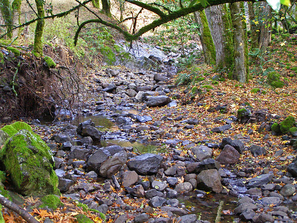
Frank Burton, who settled at the northwestern foot of Sonoma Mountain in the 1850s, claimed that the trout in nearby Copeland Creek ran so thick he could reach in and catch them by hand. Copeland Creek’s abundance of fish and year-round fresh water made it a valuable resource for Yankee pioneers like Burton, but the creek also had a checkered reputation for infidelity. In stormy conditions, Copeland Creek was known to jump watersheds, venturing from its usual streambed in the Russian River watershed to the nearby Petaluma River watershed, where it contributed to the periodic flooding of Petaluma.
Calls for imposing flood control on the wayward creek began over a century ago with the Petaluma Courier’s plea to “remedy the evils in the hills.” Those calls were raised again in the winter of 2018, after Copeland Creek jumped its banks along Lichau Road in Penngrove, spilling into an already-flooded Petaluma. As in the past, they were met with concerns over regulations, private property rights, and questions about where the money would come from.
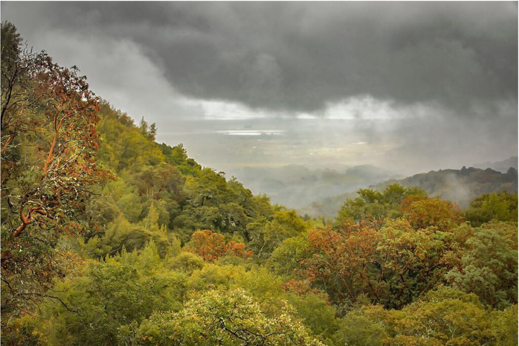
Copeland Creek originates from Elphic Spring near the summit of Sonoma Mountain, naturally flowing onto the Santa Rosa Plain at the southern edge of the Russian River watershed. While winter storms annually drop an average 23 inches of rain on the plain, the top of Sonoma Mountain, its 2,464-foot elevation literally scraping the rain from passing storm clouds, averages 50 inches.
Prior to the 1870s, rainwater flowed down Copeland Creek’s bed of basaltic armor and fanned out into a large seasonal lake across parts of current day Cotati and Rohnert Park, providing a habitat for egrets, herons, ducks, amphibians, and trout.
The increasing development of farms on the plain in the 1870s led to a large-scale draining of Copeland Creek’s seasonal wetlands. To do so, a nine-mile channel was constructed to connect the creek with the main stem of the Laguna de Santa Rosa, ultimately feeding the creek into the Russian River.
But the collection of sediment and storm debris that built up during the winter hindered the channel’s flood control function, contributing to Copeland Creek’s inclination to jump into the nearby Petaluma watershed, where it pushed debris and sediment to the Petaluma River, impeding riverboat navigation and exasperating flood conditions in Petaluma. The channeling also appears to have brought about a steep decline of trout in the creek.
In 1872, Copeland Creek became a primary water source for Petaluma, along with two other year-round creeks that flowed down Sonoma Mountain’s west slope, Adobe Creek and Lynch Creek. A diversionary dam was built midway up Copeland Creek that piped roughly half of the creek’s stream flow to Petaluma reservoirs. Even so, come rainy winter seasons, Copeland Creek failed to change its evil ways. State engineer reports in 1896 and 1902 called for remedies for shoring up its banks, but ranch owners responded by threatening the city of Petaluma with trespassing lawsuits.
In 1914, the U.S. Army Corp of Engineers recommended the construction of a restraining wall on the creek, but the Cotati Land Company, a large landholder in the southern Santa Rosa Plain, sued Petaluma, arguing that such a wall would result in flooding their farmland. Heavy rainfalls in the late 1920s brought repeated flooding to the chicken ranchers of both Petaluma and Cotati. Citizen petitions for flood control were met with a deaf ear by the Petaluma City Council.
In 2021, the City of Rohnert Park was awarded a $6 million FEMA grant toward the construction of the detention basin for Copeland Creek to help mitigate flood problems, with matching funds coming from the city’s development fees.[1] Capturing stormwater in the basin will allow a slower recharge of the groundwater while also creating habitat for fish passage, including for steelhead trout. Not so long ago they ran so thick as to be caught by hand.
[1]“Rohnert Park wins $6 million grant to help build flood-control basin,” Santa Rosa Press Democrat, November 14, 2021
https://www.fema.gov/case-study/california-copeland-creek-detention-basin